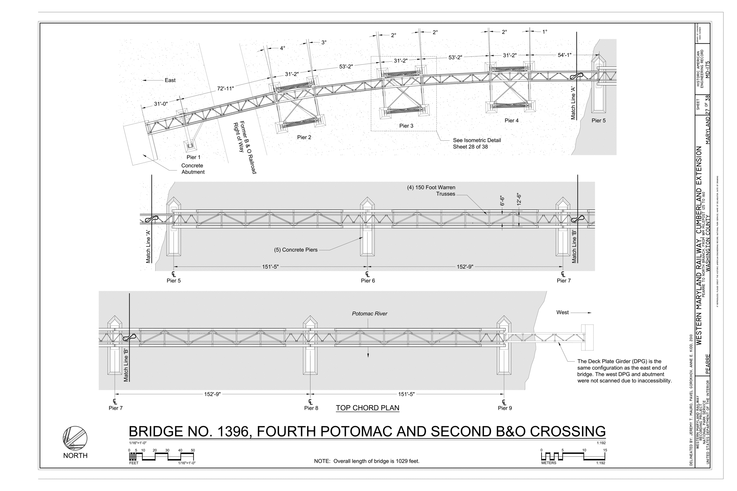
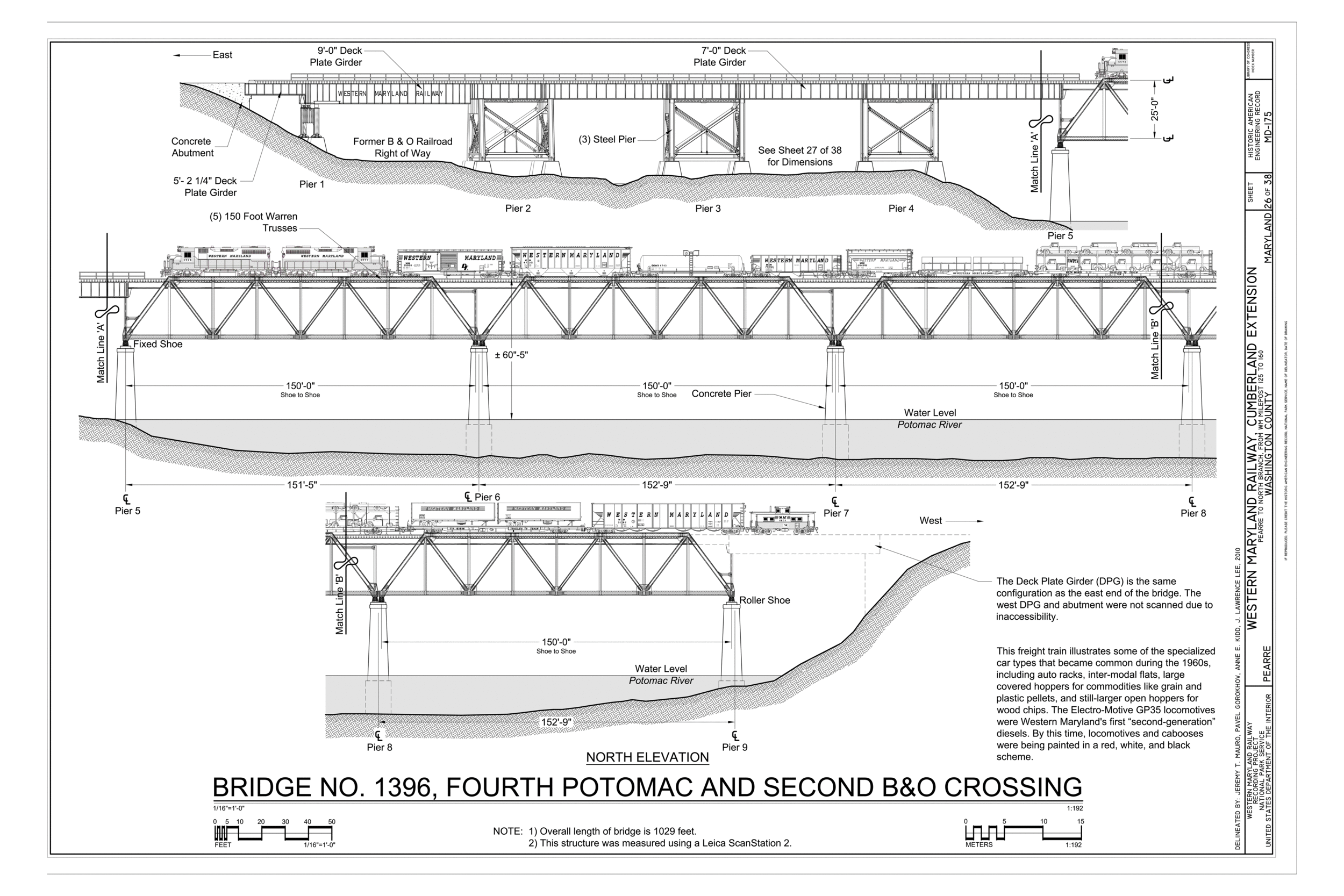


I was part of a team tasked with documenting the Western Maryland Railway section through the Paw Paw bends. We used a Leica ScanStation2 and imported the pointcloud into AutoCAD to provide dimensional information for our drawings.
The color map was created using aerial LiDAR imported into AutoCAD Map3D. It was annotated and finalized in Adobe Illustrator.
Large-format aerial photograph by HAER photographer Jet Lowe, 2011.